Weather intelligence for field operations
Weather records, claims reports and site risk. For every job you run.
AtmosDays turns NOAA and National Weather Service data into the documentation and early warnings field teams need: day-by-day weather records for delay notices, date of loss reports for claims, risk boards for energy and industrial sites, and storm alerts across every location.
14 days of Pro, then 30 days of Plus, no card · Every number cites its NOAA source · Free live radar and forecasts ›
Industries
One weather system of record across your operations
Of the job, on record
Daily weather from the nearest NOAA station, flagged days and work days lost, ready for a delay notice.
For the owner or the claim file
Daily weather, your log, the job timeline and the papers the dates came from, every source named.
Watched for warnings
Tornado, severe storm and flash flood warnings for each active job and location, on phones within minutes.
Of site risk ahead
Heat, freeze-off, wind, lightning and flood risk by site, with an all-sites board on Pro.
Product overview
See how teams use AtmosDays, in under 90 seconds
From adding a job to a finished PDF for the owner or the claim file, then claims, site risk and alerts across locations, with the forecaster-grade weather data behind it. Captioned, no sound needed.
- Job weather records against the 30-year normal
- Date of loss reports and energy site risk
- Storm alerts for every job and location
Read the tour as text
- AtmosDays turns NOAA and National Weather Service data into weather records, claims reports, site risk and alerts for field teams.
- Sign in with a work email. No password, and no card for the trial.
- Add a job or site: a name, the address, the start date and the kind of work.
- Add work orders, tickets, daily logs or photos. AtmosDays finds the dates, and the files never leave your computer.
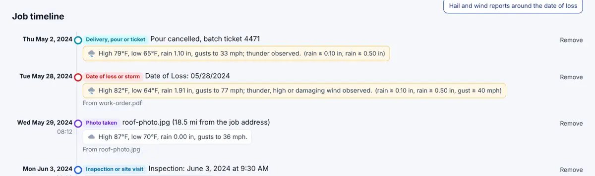
- Every date lands on the job timeline, with the weather that day.
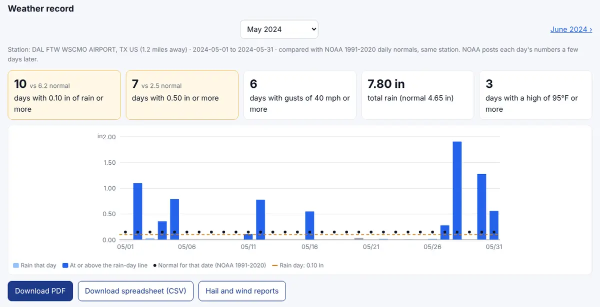
- The weather record: rain, wind, heat and cold days against NOAA's 30-year normal, and work days lost. One PDF for the owner or GC.
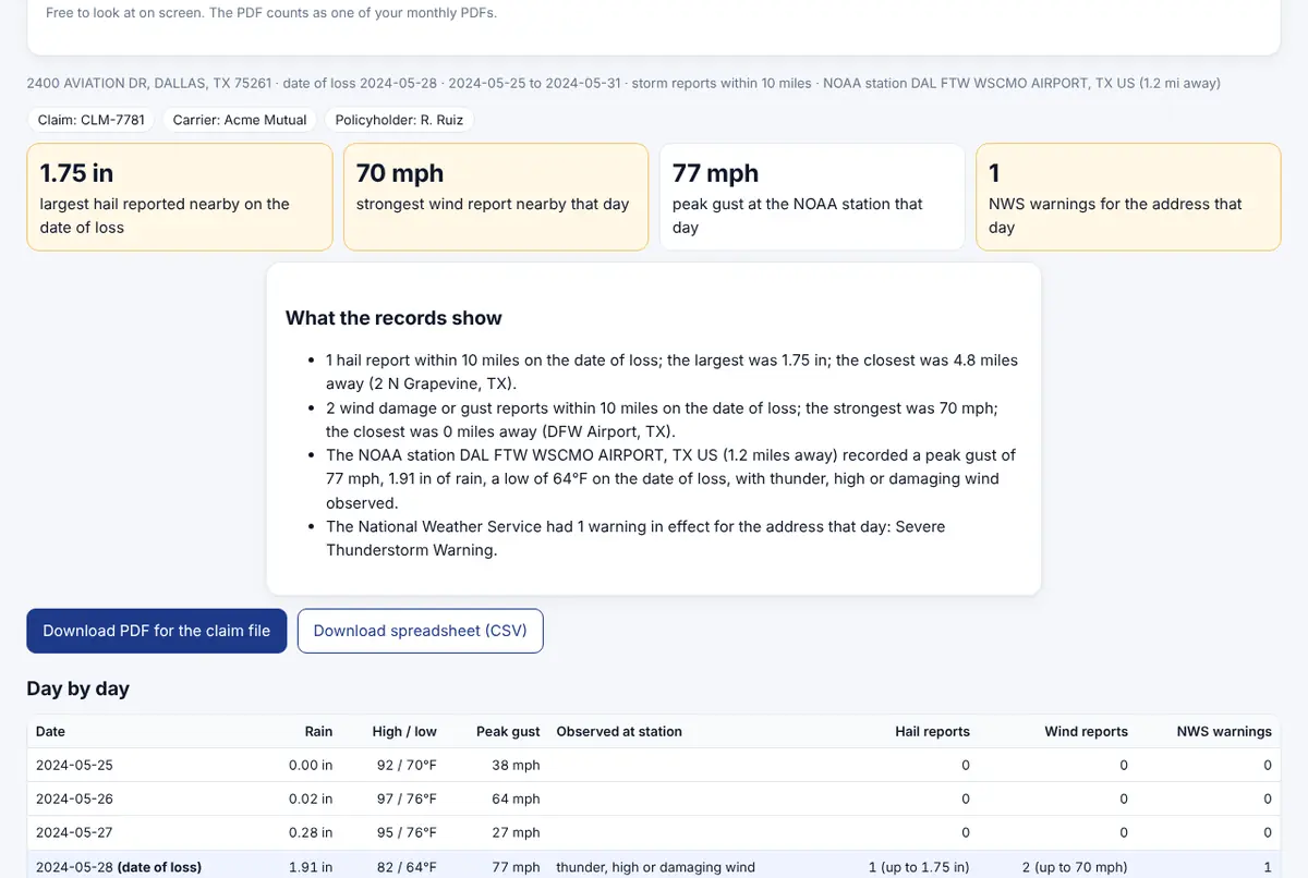
- Insurance claims: a date of loss report with hail and wind reports, measured gusts and the warnings for the property.
- Energy and industrial sites: heat, freeze-off, wind, lightning and flood risk by site, 7 days ahead.
- Alerts: tornado, severe storm and flash flood warnings for every job and place, on phones within minutes.
- Home: every job in one place, with heads-ups before the next storm.
- One New report button: pick what you need in plain words, from a job record to a snow storm.
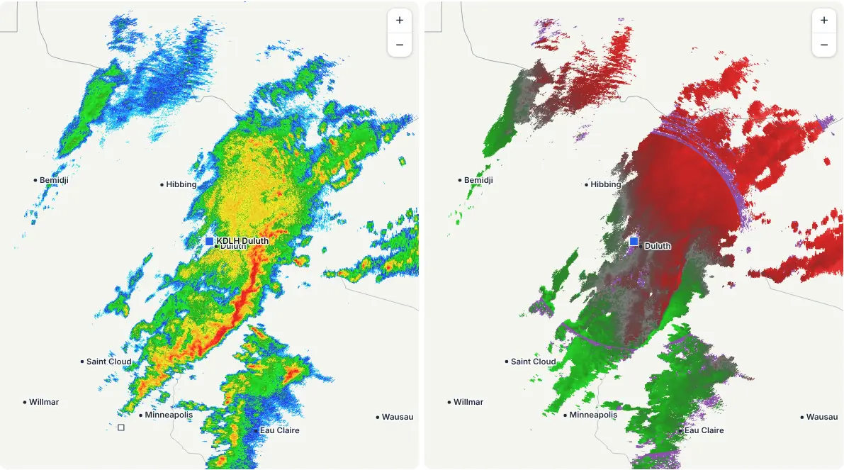
- Live NEXRAD radar with four tilts, loops and split screen, from every NOAA radar.
- Mesoanalysis: wind shear, storm fuel and the jet stream, refreshed hourly.
- Model soundings for any point, explained in plain words.
- GFS, European, AI, ensemble, NBM, HRRR, RRFS and REFS model maps with SPC and WPC outlooks.
- Hurricane tracks, spaghetti models and recon (sample storm shown).
How it works
The weather record behind every job
Add a job address and AtmosDays keeps a day-by-day record from the nearest NOAA station next to the 30-year normal, ties your paperwork and photos to the weather on each date, and warns you before the next storm.
Add the job
Address, start date and the kind of work. AtmosDays finds the nearest NOAA station and suggests thresholds for that trade.
Read the record
Rain, wind, heat and cold days against the normal, work days lost, and what the station saw, every day of the job.
Send the PDF
Daily weather, your log, the job timeline and the papers the dates came from, ready for the owner, the adjuster or the claim file.
Weather alerts
Warnings on your phone, for every job and place you care about
Turn on alerts and AtmosDays watches the National Weather Service for each active job plus places like home, the office or the yard. Tornado, severe thunderstorm and flash flood warnings arrive on your phone or computer within minutes. Free on every plan; Plus and Pro add email alerts and the 1 to 3 day heads-ups.
Alerts can come a few minutes after the warning, and phones can delay notifications. Keep Wireless Emergency Alerts on too.
Built for the way your teams work
Pick the kind of work for each job and AtmosDays sets the thresholds and wording for it.
Builders and site work
General contractors, concrete, paving, framing and painting crews.
Rain, wind, heat and cold days against the 30-year normal for every date, for delay notices and time extension requests.
Roofing and exterior
Roofers, siding, gutters and windows.
Hail and wind reports near the address, the date of loss, and gust days for the days you couldn't safely work.
Restoration
Water, fire, mold and storm restoration teams.
The weather on the date of loss and every day of mitigation, next to your job notes and photos.
Insurance claims
Public adjusters, claims consultants and estimators.
A date of loss report for the claim file: hail and wind reports near the property, measured gusts and the warnings that covered it.
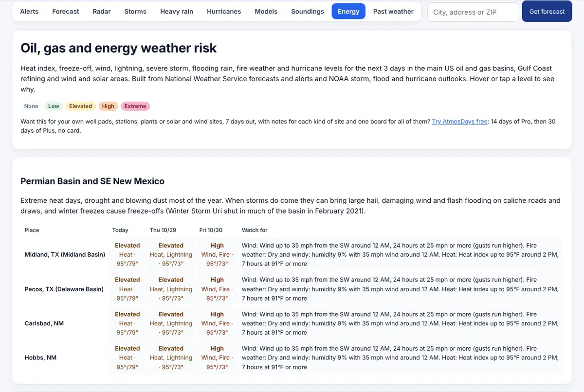
Energy and industrial sites
Well sites, pipelines, plants, power lines, solar and wind farms.
Heat, freeze-off, wind, lightning and flood risk for each site, and solar and wind output outlooks.
Utilities, cleanup and grounds
Underground utility, debris, tree service and grounds crews.
What hit the area, 3-day heads-ups before the next storm, and a day-by-day record of the work.
Your paperwork, tied to the weather
Most delay and damage questions come down to a few dates. AtmosDays reads them from the papers you already have:
- Work orders, job tickets and claim notices (PDF, Word, text or email): dates, claim and work order numbers, and the address, checked against the job.
- Delivery and batch tickets: the day of the pour or delivery and the weather that day.
- Daily logs and timesheets (Excel or CSV): each day's notes and lost hours go into your daily log.
- Job photos: when and where each photo was taken, and how far that was from the job.
Files are read on your own computer and never uploaded. AtmosDays keeps only the dates and details you choose, the file name and a fingerprint of the exact file.
vs 6.2 normal
40 mph+
days
1.91 in rain, gusts to 77 mph; thunder, high wind observed
1.10 in rain, gusts to 33 mph; thunder observed
Live weather intelligence, included
Forecaster-grade weather behind every decision
Radar, satellite, model guidance, soundings, mesoanalysis and hurricane tracking for your safety leads and planners, free for everyone at /weather and explained in plain words.
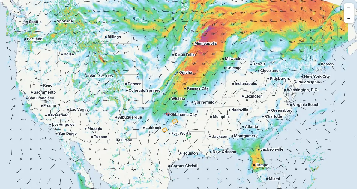 MesoanalysisShear, CAPE, the jet stream, pressure and temperature change, with station readings and warnings on top.
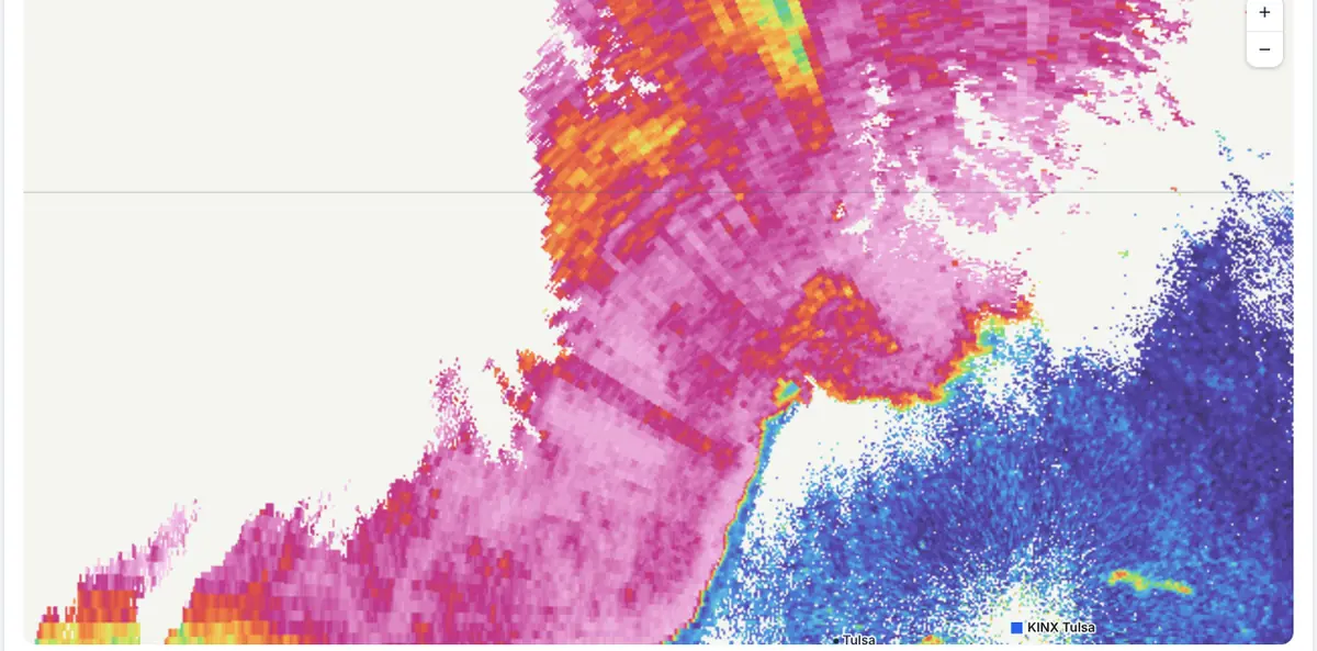 RadarEvery NOAA radar up close: reflectivity, velocity, debris and hail (CC), storm-total rain, four tilts, loops and split screen.
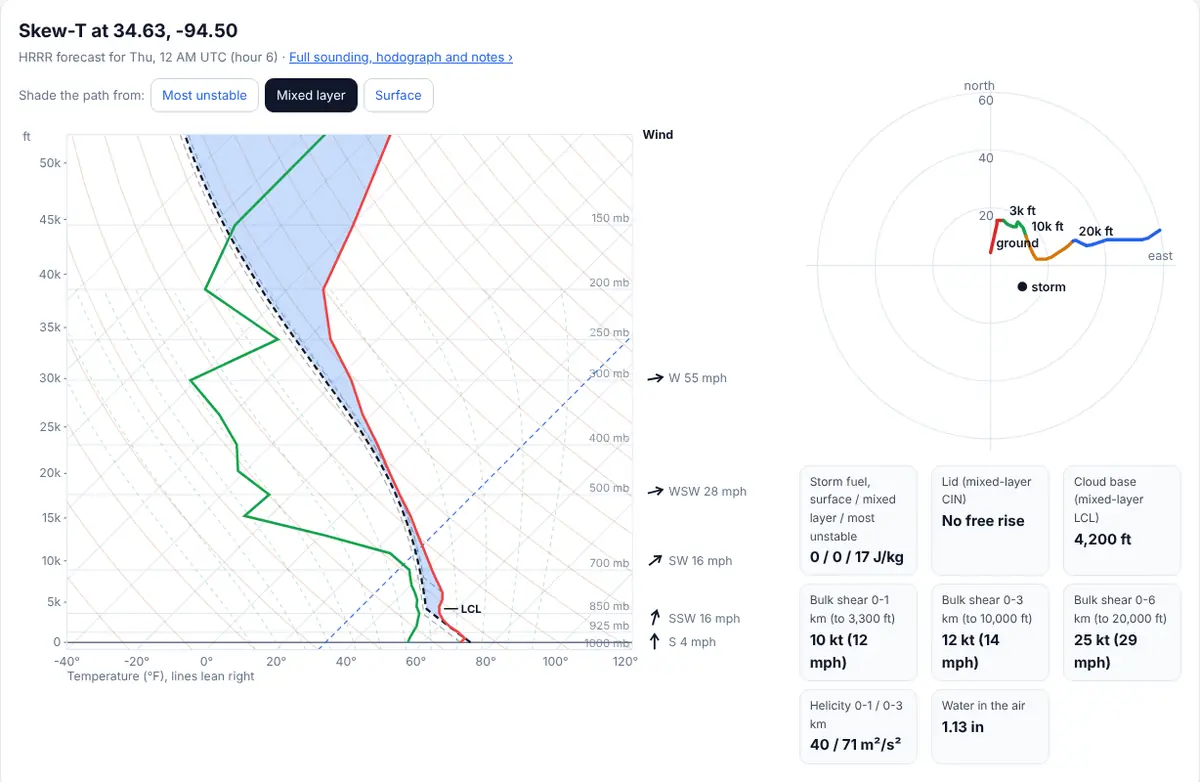 SoundingsTap anywhere for an HRRR or GFS Skew-T and hodograph, or read the latest weather balloon launches.
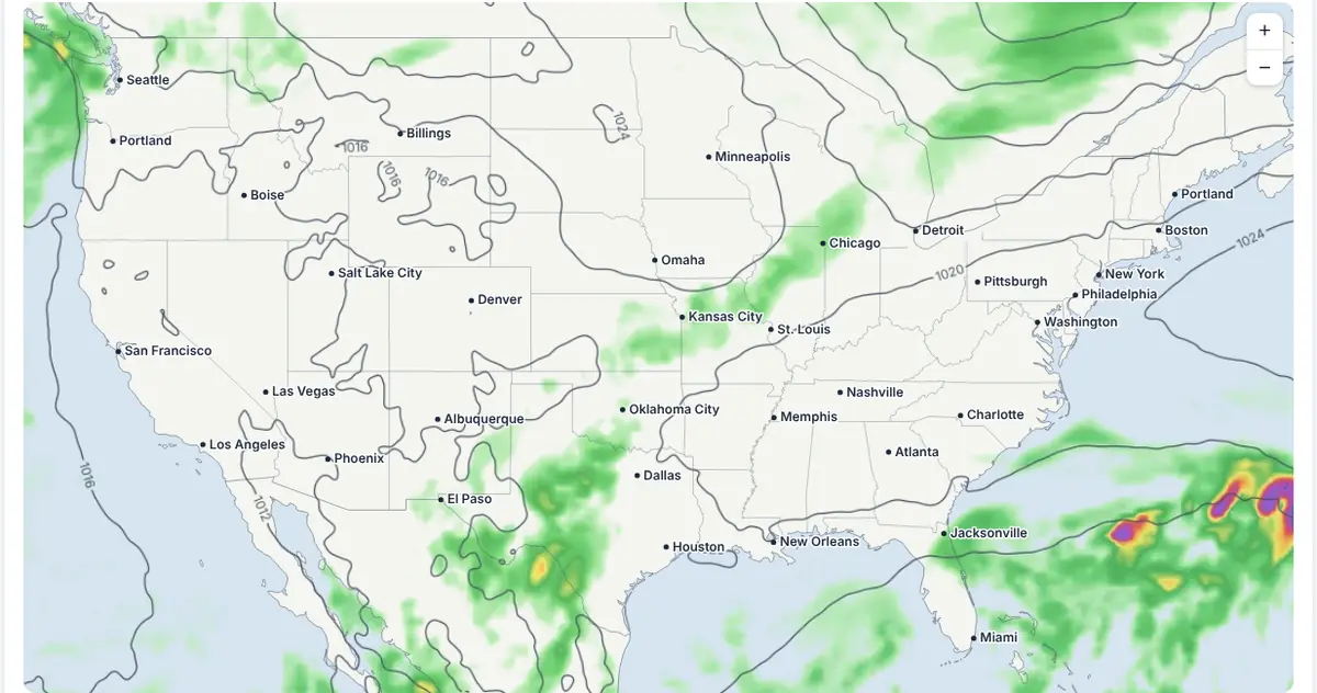 ModelsGFS, European, AI models, GEFS and NBM chances, HRRR, RRFS and REFS maps by valid time, with the SPC and WPC outlooks laid over them.
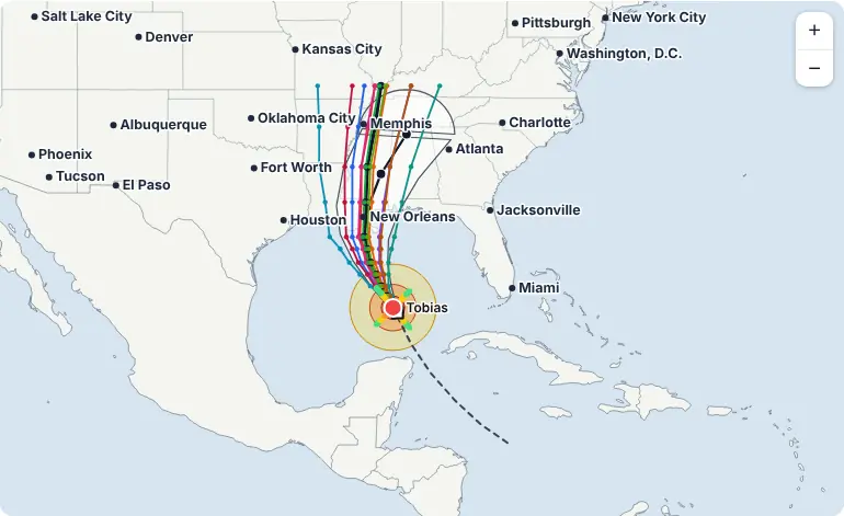 HurricanesNHC cones, spaghetti models, wind fields and Hurricane Hunter recon flights.
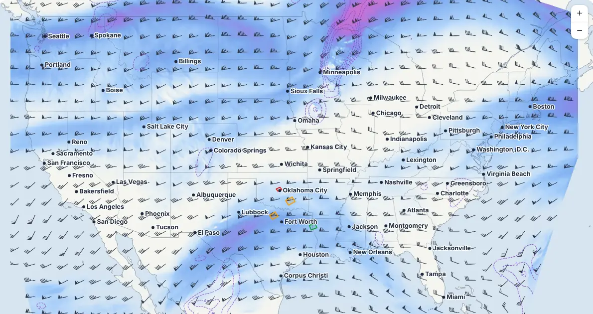 Jet stream250 mb winds and the setup above the storms, refreshed every hour.
Alerts mapForecastsGOES satelliteStorm outlooksFire weatherHeavy rainEnergy basinsPast weather
Hurricane picture uses a sample storm. Model maps refresh hourly; radar every few minutes.
Alerts before it hits
Tornado, severe storm and flash flood warnings on your phone within minutes, free on every plan, plus 3-day heads-ups for storms, heat and freezes at each job. How alerts work
Storm reports near any address
Every NOAA Storm Prediction Center hail, wind and tornado report within 5, 10 or 25 miles, with the nearest station's measured gusts.
Public, checkable data
Every number names its NOAA or National Weather Service source and station. Certified copies can be ordered from NOAA if a dispute needs them.
Plans that scale from one crew to many sites
Every new account gets 14 days of Pro, then 30 days of Plus, no card needed.
Plus
$19/mo
Up to 15 jobs
- 40 PDFs a month
- Date of loss reports
- Email alerts and heads-ups, 7-day site risk
Enterprise
Custom
More than 50 sites
- Several users and teams
- Custom thresholds and reports
- Help getting set up
The live weather tools at /weather are free for everyone. Full pricing.
Start free, with 14 days of Pro, then 30 days of Plus
No card and no password: we email you a sign-in link. Add your first job in about a minute. After the trial, Free keeps working for good for up to 3 active jobs.
AtmosDays documents the weather. Whether a day is excusable depends on your contract, notice and schedule impact, and storm exposure is not proof of damage, so those calls stay with you.
Questions
Do you have plans for larger teams?
Yes. Pro covers up to 50 active jobs or sites. For more sites, several users or custom thresholds and reports, email contact@eagleeyeinsightsllc.com and we will set up a plan that fits.
Are the weather tools free?
Yes. Radar, satellite, model maps, soundings, mesoanalysis, hurricanes, alerts and forecasts at /weather are free with no account. Paid plans are for job records, reports and heads-up emails tied to your own job sites.
Who are the paid plans for?
Any team whose work or schedule depends on the weather: builders and trades, roofers, restoration and storm cleanup crews, public adjusters and claims consultants, utility and underground contractors, and oil, gas, solar, wind and industrial site operators. Free covers 3 jobs; Plus is $19 a month and Pro is $39.
Does a record prove a delay is excusable, or that a storm caused damage?
No. It documents the weather at the nearest official station and the public storm reports and warnings near the address. Whether a delay counts depends on your contract terms, notice and schedule impact; whether a storm caused damage needs an inspection.
Where does the data come from?
NOAA and the National Weather Service: station records and 1991-2020 normals (NCEI), radar (NEXRAD), GOES satellite, Storm Prediction Center and Weather Prediction Center outlooks and reports, National Hurricane Center advisories, and the GFS, AI GFS, GEFS, NBM, HRRR, RRFS and REFS models. ECMWF open data (CC BY 4.0) for the European models (IFS and AIFS). Radar tiles and warning archives via Iowa State University. US only.
Do you keep the files I add to a job?
No. Files are read in your browser. Only what you choose to keep (dates, notes, a reference number), the file name, its size and its SHA-256 fingerprint are saved.
Why doesn't yesterday show up in a job record yet?
NOAA checks and posts each day's station numbers a few days later. The record says "not yet" until then, and the forecast covers the days ahead.
Free tools: normal weather days by city · past weather lookup · hail and wind reports · diesel and material prices